Enhancing Drone Navigation with AI and IDS uEye Camera Technology

AI-driven drone from University of Klagenfurt uses IDS uEye camera for real-time, object-relative navigation—enabling safer, more efficient, and precise inspections.
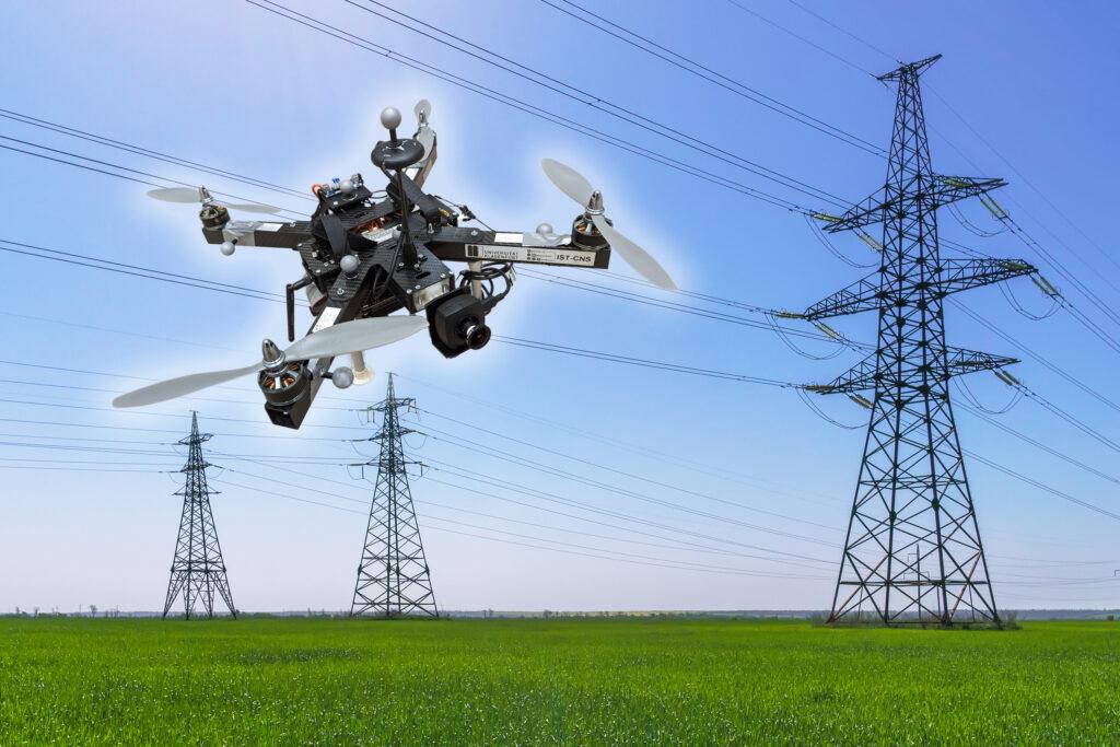
High-voltage power lines. Electricity distribution station. high voltage electric transmission tower. Distribution electric substation with power lines and transformers.

The inspection of critical infrastructures such as energy plants, bridges or industrial complexes is essential to ensure their safety, reliability and long-term functionality. Traditional inspection methods always require the use of people in areas that are difficult to access or risky. Autonomous mobile robots offer great potential for making inspections more efficient, safer and more accurate. Uncrewed aerial vehicles (UAVs) such as drones in particular have become established as promising platforms, as they can be used flexibly and can even reach areas that are difficult to access from the air. One of the biggest challenges here is to navigate the drone precisely relative to the objects to be inspected in order to reliably capture high-resolution image data or other sensor data.

A research group at the University of Klagenfurt has designed a real-time capable drone based on object-relative navigation using artificial intelligence. Also on board: a USB3 Vision industrial camera from the uEye LE family from IDS Imaging Development Systems GmbH.

As part of the research project, which was funded by the Austrian Federal Ministry for Climate Action, Environment, Energy, Mobility, Innovation and Technology (BMK), the drone must autonomously recognise what is a power pole and what is an insulator on the power pole. It will fly around the insulator at a distance of three meters and take pictures. „Precise localisation is important such that the camera recordings can also be compared across multiple inspection flights,“ explains Thomas Georg Jantos, PhD student and member of the Control of Networked Systems research group at the University of Klagenfurt. The prerequisite for this is that object-relative navigation must be able to extract so-called semantic information about the objects in question from the raw sensory data captured by the camera. Semantic information makes raw data, in this case the camera images, „understandable“ and makes it possible not only to capture the environment, but also to correctly identify and localise relevant objects.

In this case, this means that an image pixel is not only understood as an independent colour value (e.g. RGB value), but as part of an object, e.g. an isolator. In contrast to classic GNNS (Global Navigation Satellite System), this approach not only provides a position in space, but also a precise relative position and orientation with respect to the object to be inspected (e.g. „Drone is located 1.5m to the left of the upper insulator“).

The key requirement is that image processing and data interpretation must be latency-free so that the drone can adapt its navigation and interaction to the specific conditions and requirements of the inspection task in real time.
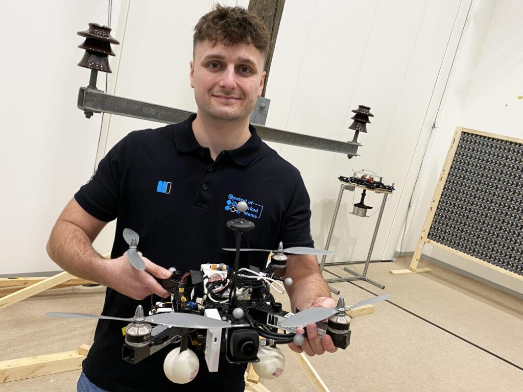
Thomas Jantos with the inspection drone – Photo: aau/Müller

Semantic information through intelligent image processing
Object recognition, object classification and object pose estimation are performed using artificial intelligence in image processing. „In contrast to GNSS-based inspection approaches using drones, our AI with its semantic information enables the inspection of the infrastructure to be inspected from certain reproducible viewpoints,“ explains Thomas Jantos. „In addition, the chosen approach does not suffer from the usual GNSS problems such as multi-pathing and shadowing caused by large infrastructures or valleys, which can lead to signal degradation and thus to safety risks.“
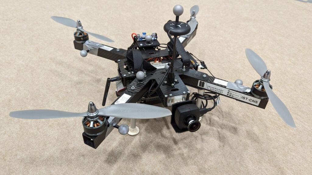
A USB3 uEye LE serves as the quadcopter’s navigation camera

How much AI fits into a small quadcopter?
The hardware setup consists of a TWINs Science Copter platform equipped with a Pixhawk PX4 autopilot, an NVIDIA Jetson Orin AGX 64GB DevKit as on-board computer and a USB3 Vision industrial camera from IDS. „The challenge is to get the artificial intelligence onto the small helicopters.

The computers on the drone are still too slow compared to the computers used to train the AI. With the first successful tests, this is still the subject of current research,“ says Thomas Jantos, describing the problem of further optimising the high-performance AI model for use on the on-board computer.

The camera, on the other hand, delivers perfect basic data straight away, as the tests in the university’s own drone hall show. When selecting a suitable camera model, it was not just a question of meeting the requirements in terms of speed, size, protection class and, last but not least, price. „The camera’s capabilities are essential for the inspection system’s innovative AI-based navigation algorithm,“ says Thomas Jantos. He opted for the U3-3276LE C-HQ model, a space-saving and cost-effective project camera from the uEye LE family. The integrated Sony Pregius IMX265 sensor is probably the best CMOS image sensor in the 3 MP class and enables a resolution of 3.19 megapixels (2064 x 1544 px) with a frame rate of up to 58.0 fps. The integrated 1/1.8″ global shutter, which does not produce any ‚distorted‘ images at these short exposure times compared to a rolling shutter, is decisive for the performance of the sensor. „To ensure a safe and robust inspection flight, high image quality and frame rates are essential,“ Thomas Jantos emphasises. As a navigation camera, the uEye LE provides the embedded AI with the comprehensive image data that the on-board computer needs to calculate the relative position and orientation with respect to the object to be inspected. Based on this information, the drone is able to correct its pose in real time.

The IDS camera is connected to the on-board computer via a USB3 interface. „With the help of the IDS peak SDK, we can integrate the camera and its functionalities very easily into the ROS (Robot Operating System) and thus into our drone,“ explains Thomas Jantos. IDS peak also enables efficient raw image processing and simple adjustment of recording parameters such as auto exposure, auto white Balancing, auto gain and image downsampling.

To ensure a high level of autonomy, control, mission management, safety monitoring and data recording, the researchers use the source-available CNS Flight Stack on the on-board computer. The CNS Flight Stack includes software modules for navigation, sensor fusion and control algorithms and enables the autonomous execution of reproducible and customisable missions. „The modularity of the CNS Flight Stack and the ROS interfaces enable us to seamlessly integrate our sensors and the AI-based ’state estimator‘ for position detection into the entire stack and thus realise autonomous UAV flights. The functionality of our approach is being analysed and developed using the example of an inspection flight around a power pole in the drone hall at the University of Klagenfurt,“ explains Thomas Jantos.
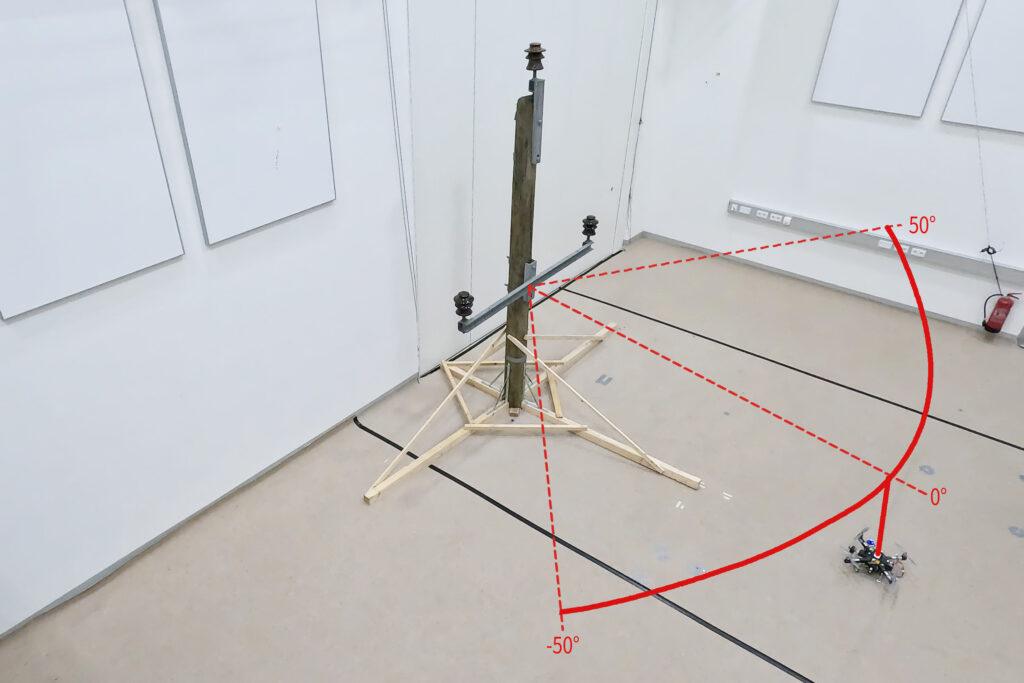
Visualisation of the flight path of an inspection flight around an electricity pole model with three insulators in the research laboratory at the University of Klagenfurt

Precise, autonomous alignment through sensor fusion
The high-frequency control signals for the drone are generated by the IMU (Inertial Measurement Unit). Sensor fusion with camera data, LIDAR or GNSS (Global Navigation Satellite System) enables real-time navigation and stabilisation of the drone – for example for position corrections or precise alignment with inspection objects. For the Klagenfurt drone, the IMU of the PX4 is used as a dynamic model in an EKF (Extended Kalman Filter). The EKF estimates where the drone should be now based on the last known position, speed and attitude. New data (e.g. from IMU, GNSS or camera) is then recorded at up to 200 Hz and incorprated into the state estimation process.

The camera captures raw images at 50 fps and an image size of 1280 x 960px. „This is the maximum frame rate that we can achieve with our AI model on the drone’s onboard computer,“ explains Thomas Jantos. When the camera is started, an automatic white balance and gain adjustment are carried out once, while the automatic exposure control remains switched off. The EKF compares the prediction and measurement and corrects the estimate accordingly. This ensures that the drone remains stable and can maintain its position autonomously with high precision.
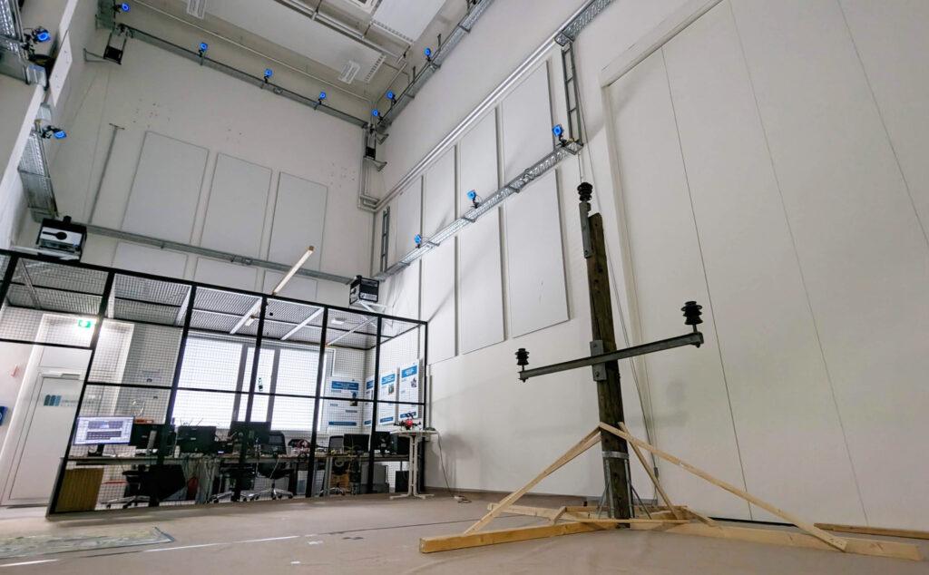
Electricity pole with insulators in the drone hall at the University of Klagenfurt is used for test flights

Outlook
„With regard to research in the field of mobile robots, industrial cameras are necessary for a variety of applications and algorithms. It is important that these cameras are robust, compact, lightweight, fast and have a high resolution. On-device pre-processing (e.g. binning) is also very important, as it saves valuable computing time and resources on the mobile robot,“ emphasises Thomas Jantos.

With corresponding features, IDS cameras are helping to set a new standard in the autonomous inspection of critical infrastructures in this promising research approach, which significantly increases safety, efficiency and data quality.

The Control of Networked Systems (CNS) research group is part of the Institute for Intelligent System Technologies. It is involved in teaching in the English-language Bachelor’s and Master’s programs „Robotics and AI“ and „Information and Communications Engineering (ICE)“ at the University of Klagenfurt. The group’s research focuses on control engineering, state estimation, path and motion planning, modeling of dynamic systems, numerical simulations and the automation of mobile robots in a swarm: More information
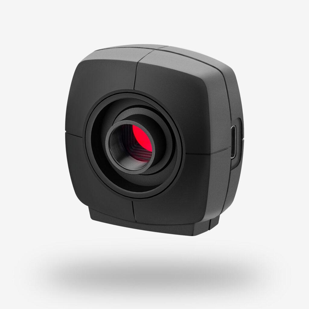
uEye LE – the cost-effective, space-saving project camera
Model used:USB3 Vision Industriekamera U3-3276LE Rev.1.2
Camera family: uEye LE

Image rights: Alpen-Adria-Universität (aau) Klagenfurt
© 2025 IDS Imaging Development Systems GmbH

Die Maker sind wieder los

Hannover, 18. Juli 2024 – Die Maker Faire Hannover feiert am 17. und 18. August ihr 10-jähriges Jubiläum im HCC Hannover Congress Centrum. Als drittgrößte Veranstaltung ihrer Art weltweit zählt sie zu den wichtigsten internationalen Maker-Treffen. Bis zu 15.000 Teilnehmer geben sich hier ein Stelldichein und bestaunen Hunderte von Projekten an rund 250 Ständen, tauschen sich aus und lernen voneinander. Das gesamte Ausstellungsprogramm ist unter dem Punkt „Meet the Makers” jetzt online abrufbar.

„Die Maker Faire Hannover ist eine einzigartige Mischung aus Wissenschaftsmesse und Jahrmarkt”, erklärt Daniel Rohlfing, Direktor der Veranstaltung. „Wir nennen es The Greatest Show & Tell on Earth. Die Veranstaltung bietet eine Plattform für Aussteller und Besucher, um sich über Themen wie 3D-Druck, Lasercutting, Mikrocontroller, Coding, Robotik und vieles mehr auszutauschen. Doch es ist weder ein Event nur für Nerds noch eine klassische Messe. Das Präsentieren von Projekten, das Miteinander und der generationsübergreifende Wissensaustausch stehen im Vordergrund, abgerundet durch ein buntes Rahmenprogramm.“

Ein besonderes Highlight der Veranstaltung sind die spektakulären Shows. In diesem Jahr präsentiert der Ingenieur Matthias Vijverman von Mécanique Fantastique sein „Steam Bike” und die Feuershow „Watch?!” – eine vier Meter hohe mechanische Installation mit unzähligen beweglichen Teilen.

Neben den größeren Attraktionen zeigen private Maker, Hochschulen mit MINT-Schwerpunkten, Unternehmen und viele Makerspaces ihre inspirierenden Projekte und innovativen Produkte. Es gibt eine KI-Ideenwerkstatt für Umweltschutz, ein Roboter-Herz, eine simulierte Knieoperation durch einen Roboterarm, Quantensensoren zum Anfassen, einen autonomen Tauchroboter namens BumbleBee, ChatGPT-Telefonie und ein digitales Periskop, mit dem man sich virtuell an faszinierende Orte teleportieren kann. Aber auch herumwuselnde R2D2-Roboter, Cosplayer, selbstgebaute Greif- und Arcade-Automaten, ein Mitmach-Fernsehstudio der Marke Eigenbau, das Equipment der 80er und 90er Jahre mit aktueller Technik verbindet und vieles mehr.

Weitere Informationen zur Maker Faire Hannover sind auf der Website zu finden, dort kann man über das Ausstellerverzeichnis Genaueres über die ausstellenden Maker erfahren.

Die Veranstaltung steht unter der Schirmherrschaft von Bundesbildungsministerin Bettina Stark-Watzinger. Sie betont, dass neben der fachlichen Kompetenzförderung auch das Selbstvertrauen und die Offenheit für Neues gestärkt werde. Steffen Krach, Präsident der Region Hannover und Botschafter der Veranstaltung, wird das Jubiläum eröffnen. Diesjähriger Hauptsponsor ist Basic Solar, die Photovoltaik einfach und günstig machen.

Tickets für die Maker Faire Hannover sind im Onlineshop oder an der Tageskasse erhältlich. Das Einzelticket für Erwachsene kostet 19,80 Euro, ermäßigt 15,80 Euro. Familientickets gibt es ab 30 Euro, für Kinder unter 10 Jahren ist der Eintritt frei. Die Veranstaltung öffnet am Samstag von 10 bis 18 Uhr und am Sonntag von 10 bis 17 Uhr.

Über die Maker Faire Hannover: Seit 2013 begeistert die Maker Faire Hannover als Plattform für Inspiration, Kreativität und Innovation Teilnehmer aller Altersgruppen. Die Veranstaltung bringt Technik, Handwerk und Kunst zusammen und hat sich zu einem festen Termin im Kalender der internationalen Maker-Szene etabliert.

Festo at Hannover Fair unveils Bionic Honeybees that fly in swarms

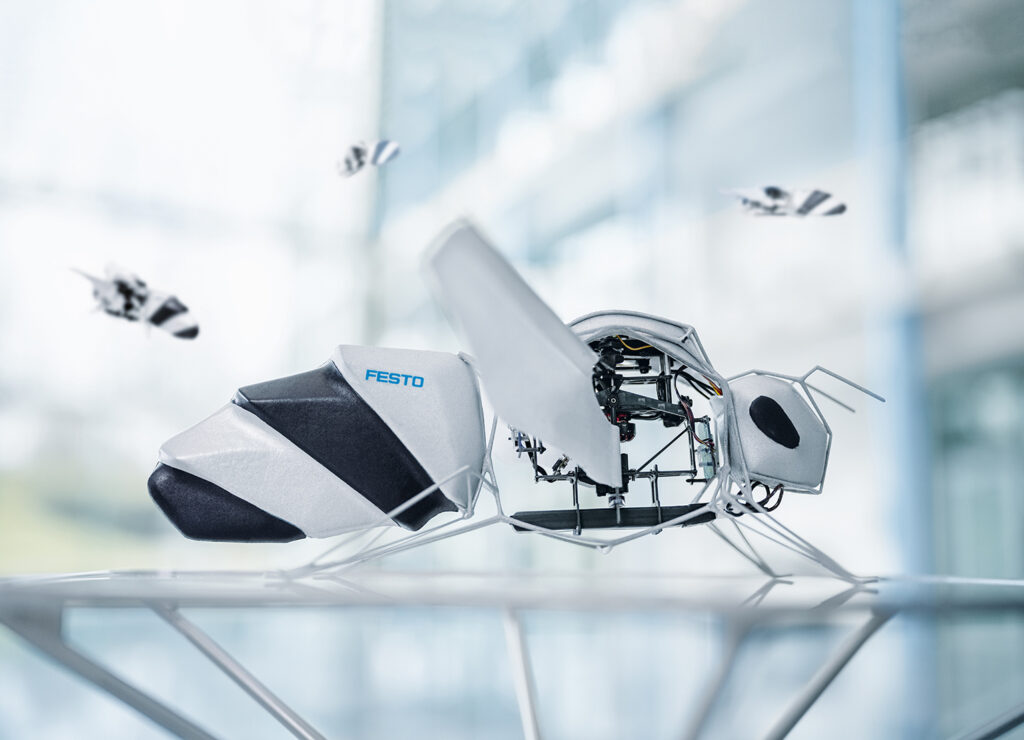
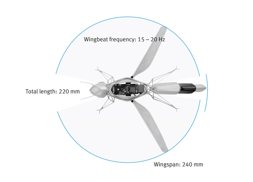
For more than 15 years, the Bionic Learning Network has been focusing on the fascination of flying. In addition to the technical decoding of bird flight, the team has researched and technologically implemented numerous other flying objects and their natural principles. With the BionicBee, the Bionic Learning Network has now for the first time developed a flying object that can fly in large numbers and completely autonomously in a swarm. The BionicBee will present its first flight show at the Hannover Messe 2024.

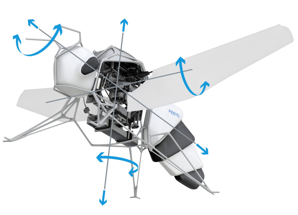
At around 34 grams, a length of 220 millimetres and a wingspan of 240 millimetres, the BionicBee is the smallest flying object created by the Bionic Learning Network to date. For the first time, the developers used the method of generative design: after entering just a few parameters, a software application uses defined design principles to find the optimal structure to use as little material as necessary while maintaining the most stable construction possible. This consistent lightweight construction is essential for good manoeuvrability and flying time.

Autonomous flying in a swarm

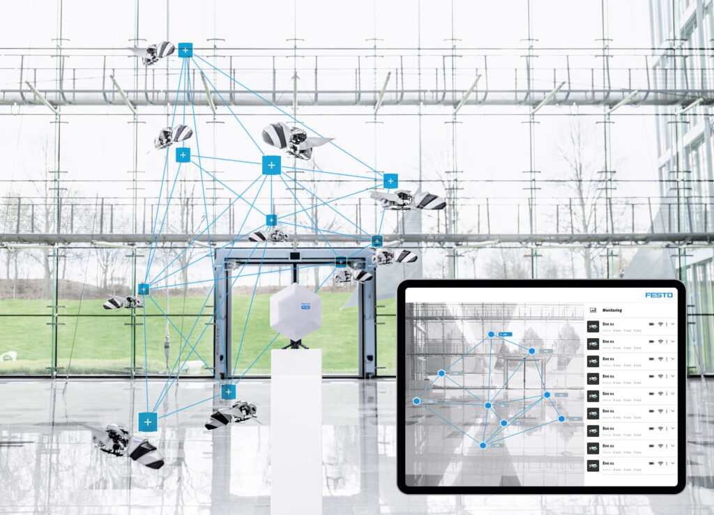
The autonomous behavior of the bee swarm is achieved with the help of an indoor locating system with ultra-wideband (UWB) technology. For this purpose, eight UWB anchors are installed in the space on two levels. This enables an accurate time measurement and allows the bees to locate themselves in the space. The UWB anchors send signals to the individual bees, which can independently measure the distances to the respective transmitting elements and calculate their own position in the space using the time stamps.

To fly in a swarm, the bees follow the paths specified by a central computer. To ensure safe and collision-free flight in close formation, a high degree of spatial and temporal accuracy is required. When planning the path, the possible mutual interaction through air turbulence “downwash” must also be taken into account.

As every bee is handmade and even the smallest manufacturing differences can influence its flight behavior, the bees additionally have an automatic calibration function: After a short test fl ight, each bee determines its individually optimized controller parameters. The intelligent algorithm can thus calculate the hardware differences between the individual bees, allowing the entire swarm to be controlled from outside, as if all bees were identical.

skyzr: Wie professionelle Drohnendienstleister neue Perspektiven eröffnen

Wien, am 10. Jänner 2024 – Es gibt kaum einen Menschen, dem Drohnen noch kein Begriff sind. Ihre Einsatzbereiche sind aber vielfältiger, als man annehmen mag. Gerade in der Bau- und Immobilienbranche können Drohnen neue und kostengünstige Blickwinkel eröffnen. Der österreichische Drohnendienstleister skyzr holt verschiedene Anwendungsbereiche vor den Vorhang und erklärt das Potential der kleinen Helfer im Zivilbereich.

„Ein kleines Objekt wie eine Gartenlaube ist schnell und unkompliziert inspiziert. Bei großen Gebäuden oder Grundstücken sieht das schon wieder anders aus. Wer nicht gerade über eine Hebebühne verfügt, muss sich in den meisten Fällen mit Eindrücken vom Boden aus begnügen. Drohnen können sich allerdings frei bewegen und helfen so dabei, sich ein umfassendes Bild zu verschaffen“, erläutert Markus Bardach, CEO von skyzr, den großen Vorteil von Drohnen.

Skyzr hat es sich zur Aufgabe gemacht, Anbieter und Kunden von Drohnendienstleistungen zusammenzubringen. „Es braucht für verwertbare Luftbildaufnahmen keine teuren, umweltschädlichen Hubschrauber mehr. Im Prinzip reicht eine Drohne in der Größe einer Cornflakes-Packung und ein Profi, der sie bedienen kann. Wir haben mit skyzr eines der größten Portfolios an zertifizierten, professionellen Drohnenpiloten im deutschsprachigen Raum und helfen dabei, den Passenden zu finden“, so Bardach. Die Einsatzgebiete dabei sind grundverschieden: vom Flug durch große Schlösser hin zur Zählung von Weinreben, kennt skyzr für jeden Fall den richtigen Experten.

Großes Motiv, kleine Kamera

So ermöglichen es Drohnen, spektakuläre Luftaufnahmen von Objekten zu liefern, die zum Verkauf stehen und schaffen so für Interessierte einen besseren Überblick. Sie können auch dabei helfen, Probleme zu identifizieren, die vom Boden aus gar nicht erkennbar sind. Dazu können 3D-Modelle von Objekten erstellt werden, die dann die Grundlage für Berichte, Vermessungen, Sanierungen oder Reparaturen sind“, sieht Bardach die Vorteile für Immobilienverwalter und

Versicherungsunternehmen gegeben. Gleichfalls eignen sich Drohnen aber auch schon für die Planung und demBau von Immobilien. „Mithilfe von Drohnen sind Vermessungsarbeiten und die Dokumentation von Baufortschritten so effizient und kostensparend wie noch nie.“

Doch nicht nur bei Immobilien profitiert man vom Auge am Himmel. „Industrieanlagen oder große Photovoltaik-Farmen können mithilfe von Drohnenaufnahmen und der richtigen Software viel effizienter und sicherer gestaltet werden. Anstatt jedes Panel einzeln kontrollieren zu müssen, kann mittels Wärmebildkamera die Leitfähigkeit der einzelnen Solarpaneele überprüft werden“, so Bardach.

Rechtssicherheit durch skyzr

Doch skyzr vermittelt nicht nur Kunden und Anbieter, sondern stellt auch sicher, dass alle erforderlichen Genehmigungen vorhanden sind. Denn in der EU gibt es für spezielle Drohnenflüge eigens ein Specific Operations Risk Assessment (SORA), um das Risiko eines Fluges einzuschätzen. „Wir unterstützen und beraten die Piloten bei allen Genehmigungsprozessen, auch bei SORA Anträgen, und achten darauf, dass alle Flüge legal und mit entsprechendem Versicherungsschutz, sowie DSGVO-konform durchgeführt werden. Zusätzlich haben wir ein Tool entwickelt, um den Genehmigungsprozess für Drohnenpiloten zu vereinfachen und den Zeitaufwand deutlich zu minimieren“, so Bardach.

Über skyzr:

Gegründet im Jahr 2020 und mit Sitz in Wien, ist skyzr ein innovatives Corporate Start-Up der renommierten Frequentis Gruppe. skyzr hat es sich zur Aufgabe gemacht, Kunden und Drohnenbetreiber branchenübergreifend zusammenzubringen und zu unterstützen. Darüber hinaus bietet skyzr maßgeschneiderte Softwarelösungen an, die eine zuverlässige Flugplanung durch Risikobewertungen ermöglichen und Genehmigungsprozesse vereinfachen. Damit reduziert skyzr den administrativen Aufwand und erhöht die Effizienz und Sicherheit von Drohneneinsätzen. Mit über 650 registrierten professionellen Drohnenpiloten ist skyzr eine der größten Drohnendienstleistungsplattformen im deutschsprachigen Raum. skyzr betreibt mit dein-drohnenpilot.de auch eine Communityplattform für hobbymäßige und professionelle Drohnenpiloten und alle, die es noch werden wollen. Weitere Informationen unter skyzr.com.

Drohnenfans aufgepasst: DJI-Store eröffnet im Olympia Einkaufszentrum

Ubstadt-Weiher / München, 19. Juli 2023 – Aufstellen, Knopf drücken und abheben: Am Freitag, den 4. August 2023 öffnet der brandneue DJI-Store im Olympia-Einkaufszentrum (OEZ) in München seine Türen. Am Eröffnungswochenende locken besondere Highlights: Kunden profitieren von attraktiven Angeboten und erhalten am Freitag und Samstag Rabatt auf ihren Einkauf (Neuprodukte ausgenommen).

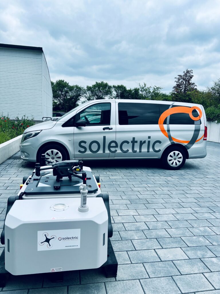
Größter Vertriebspartner von DJI ist Solectric. Die Modelle des weltweit führenden Kameradrohnenherstellers DJI sind auch hierzulande längst bekannt und gefragt. Die Geräte zeichnen sich durch ihre hochwertige Verarbeitung, innovative Technologie und vielseitigen Einsatzmöglichkeiten aus und bieten eine beeindruckende Flugstabilität und präzise Steuerung. In Solectric hat DJI nicht nur seinen größten Distributor, sondern ebenso den idealen Partner für die Positionierung im deutschen Markt gefunden.

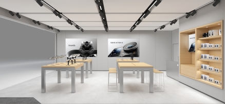
Solectric möchte zusätzlich zu erstklassigen Produkten, auch ein einzigartiges Shopping-Erlebnis bieten. Deshalb erweiterte das Unternehmen 2017 mit dem ersten DJI-Store Deutschlands in Frankfurt am Main seinen Vertriebsweg. Denn die Kauferfahrung in der Filiale geht über die im Online-Shop hinaus: Kunden können im Store die Kameradrohnen, Action Cams und Gimbals hautnah erleben und sich von Fachkräften beraten lassen. Zudem laden die DJI-Stores Besucher zu einer faszinierenden Benutzererfahrung ein. In einem Flugkäfig finden regelmäßig Drohnenflüge und spannende Produktvorführungen statt.

Bald geht all das auch am neuen Münchner Standort. Geschultes Personal steht Kundinnen und Kunden bei Fragen zur Seite und unterstützt bei der Auswahl der passenden Technik.

Im neuen DJI-Store finden des Weiteren zukünftig regelmäßig Workshops zu verschiedenen Themen statt. Auch am Eröffnungswochenende sind kleine Trainings und ausführliche Beratungen zu bestimmten Produkten in Planung.

Über anstehende Events informiert die neue Homepage djistore.de, die Ende Juli live gehen soll. Der neue Standort hat zudem einen eigenen Instagram-Kanal: djistore_muenchen.

Die Öffnungszeiten des DJI-Stores im Münchner Olympia Einkaufszentrum sind von 9:30 bis 20:00 Uhr.

Solectric zeigt, warum voll automatisierte Drohnenflüge die Luftfahrt revolutionieren

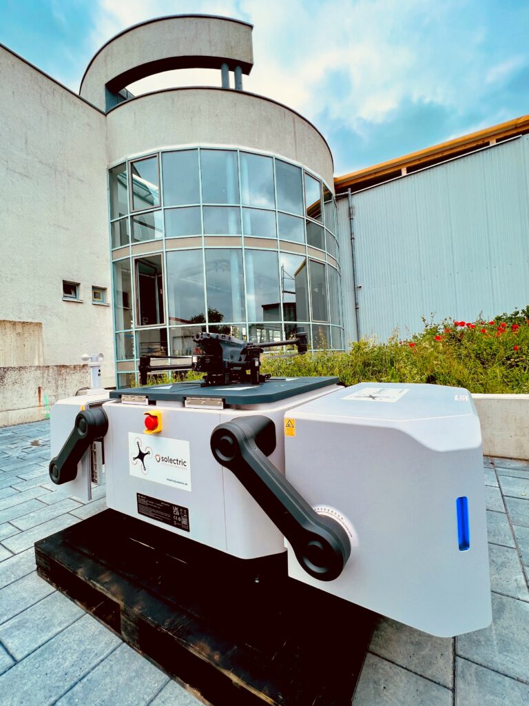
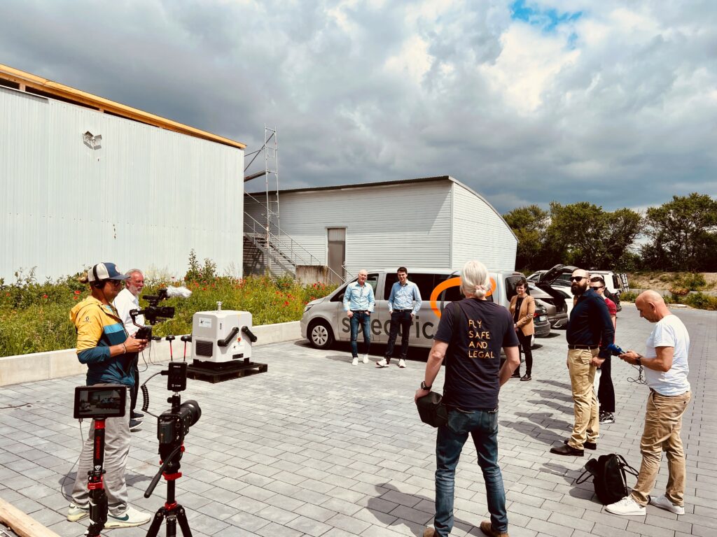
Ubstadt-Weiher, 25. Mai 2023 – Staunende Gesichter auf dem Firmengelände von Solectric: Einer der ersten voll automatisierten Drohnenflüge in Europa sorgt am Nachmittag des 23. Mai 2023 für offene Münder. Die extra dafür eingeladenen Medienvertreter haben gerade miterlebt, wie eine DJI-Drohne vom Typ Matrice 30T eine zuvor programmierte Route autonom bewältigt. Die Pressevorführung hat einen ersten Vorgeschmack auf die bevorstehende Zukunft geliefert. Denn vor allem im industriellen und behördlichen Bereich bieten sich unzählige Möglichkeiten. Von der regelmäßigen Beobachtung größerer Flächen über geplante Flüge zur Wartung von Großanlagen bis hin zu Einsätzen in schwer zugänglichen Regionen – voll automatisierte Drohnenflüge revolutionieren künftig die Luftfahrt.

DJI Dock ermöglicht dauerhaften Flugbetrieb

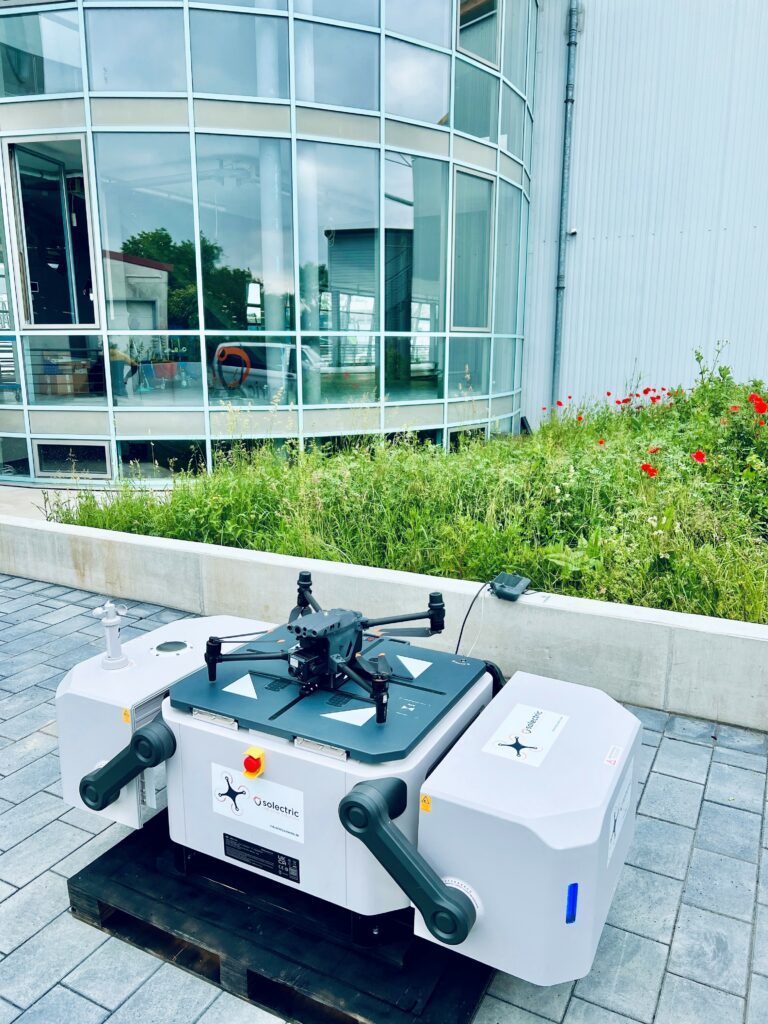
Das für die Revolution notwendige technische Equipment hat Solectric mit der DJI Dock bereits heute im Angebot. Die robuste Docking-Station von DJI, einem der weltweit führenden Hersteller von Kameradrohnen im zivilen Einsatz, eignet sich für den 24/7-Betrieb.

Das kleine Kraftpaket erfüllt drei wesentliche Funktionen:

  • Es schützt die darin integrierte Drohne.
  • Es dient als Start- und Landefläche.
  • Es lädt den Drohnen-Akku in nur 25 Minuten fast vollständig auf.

Wind und Wetter können der ca. 100 Kilogramm schweren Docking-Station nichts anhaben. Auch bei extremer Hitze oder klirrender Kälte hebt, die mit einer hochauflösenden Kamera ausgestatte Matrice 30T Drohne zum Flug ab.

Mit Hilfe der Software DJI FlightHub 2 lassen sich Routen im Vorfeld punktgenau planen. Außerdem sendet die Drohne während des Flugs Bilder, Videos, Daten und Informationen an die Software. Diese können per Cloudverbindung in Echtzeit angeschaut und kontrolliert werden.

Langer Anlauf für das behördliche Go

So eine Routenplanung hat der für voll automatische Drohnenflüge zertifizierte Solectric-Pilot Kevin Dillmann im Vorfeld der Presseveranstaltung vorgenommen. „Mit der Software DJI FlightHub 2 kann ich bestimmte GPS-Punkte, Drehpunkte oder Flugmanöver einprogrammieren. Ich kann auch vorab festlegen, welche Bilder oder Videos mir die Drohne liefern soll. So kann mir die Kamera auf Wunsch Wärmebilder von Flächen oder Objekten liefern.“

Bis zu diesem Jungfernflug in Europa hat Solectric einen langen Weg beschritten. Die Planungen für einen der ersten voll automatisierten Drohnenflüge haben vor über zwei Jahren begonnen.

Mit Unterstützung durch das Bundesverkehrsministerium hat Solectric als erstes deutsches Unternehmen sämtliche Betriebsgenehmigungen für einen solchen voll automatisierten Drohnenflug erhalten. Dabei hat Solectric vor allem von der Unterstützung durch die German Dynamic Drone Center GmbH (GDDC GmbH) profitiert.

In weiser Voraussicht hat die GDDC GmbH, als Spezialist für den industriellen Einsatz von Drohnen im europäischen Raum, die Solectric-Piloten gleich für den europaweiten Einsatz geschult. Daher dürfen sich Kevin Dillmann und Volker Wild nun offiziell Fernpiloten für voll automatisierte Drohnenflüge in Europa nennen.

Bei der Flugpremiere saßen die Piloten in einem 200 Meter entfernten Gebäude. Für die Pressevorführung unterstützte Berufspilot Horst Zell das Solectric-Team. So beschreibt der Pilot mit 30 Jahren Flugerfahrung den Moment kurz vor und kurz nach dem Start: „Einfach beeindruckend, die staunenden Gesichter zu erleben, als die DJI Dock sich öffnet, die Matrice 30T langsam abhebt, die verschiedenen Geo-Punkte abfliegt und ihre Mission erfüllt. Das wird eine Revolution in der Luftfahrt.“ 

Revolution beginnt im industriellen Einsatz

Der Sachverständige für Windkraftanlagen und Rotorblätter muss es wissen. Denn gerade bei der Wartung von Windkraftanlagen auf hoher See eignen sich voll automatisch fliegende Drohnen viel besser als Menschen.

Auch in weiteren Bereichen arbeiten die fliegenden Helfer zuverlässiger als jeder Mensch und leisten gleichzeitig ihren Teil zum Klimaschutz:

  • Waldbrände verhindern oder frühzeitig eindämmen: In immer kürzerer Folge erlebt Deutschland Hitzesommer mit Rekordtemperaturen und längeren Dürrephasen. Dadurch hat sich das Risiko von Waldbränden vervielfacht. Durch regelmäßige voll automatisierte Drohnenflüge lassen sich Brandherde frühzeitig erkennen.
  • Forschungsflüge in Gletschergebieten: Durch die steigenden Temperaturen sterben viele Gletscher in den Alpen. Mit Hilfe von autonom fliegenden Drohnen lassen sich Temperaturveränderungen dokumentieren. Anhand der Ergebnisse kann nach Lösungen geforscht werden, um das Schmelzen der Gletscher zu verlangsamen.
  • Erschaffung neuer Lebensräume: Autonom fliegende Drohnen eignen sich auch als fliegende Saathelfer. Auf diese Weise haben sich in Australien karge, trockene Regionen wieder in vitale, grüne Oasen zurückverwandelt. Die neuen Wälder dienen zahlreichen Tieren als natürlicher Lebensraum.
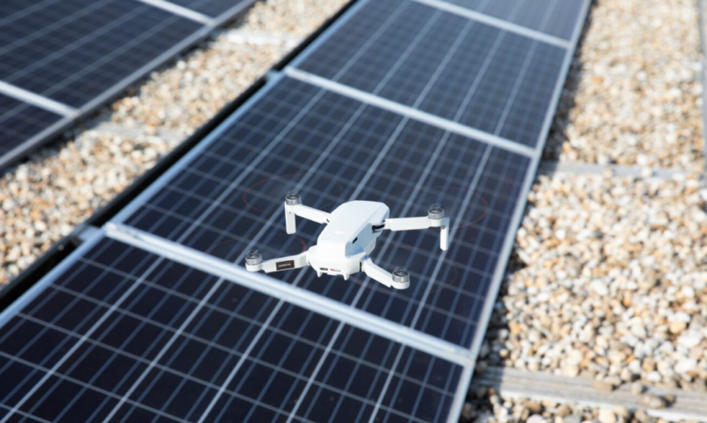
  • Weiter Anwendungen wie Solarpanel Inspektion, Überwachung Betriebsgelände und techn. Anlagen, DLRG Unterstützung bei Überwachung von Stränden

Mit der DJI Dock und der DJI FlightHub 2 hat Solectric die Zukunft der Luftfahrt eingeläutet. Die robuste Docking-Station und die intelligente Software gibt es bald bei Solectric, dem größten europäischen Vertriebshändler von DJI-Drohnen, zu kaufen.

Neue Stores im Anflug: DJI-Drohnen starten bald in München & Oberhausen

Ubstadt-Weiher, 04. Mai 2023 – Drohnen-Freunde im Süden und Westen der Republik dürfen sich freuen: Noch in diesem Jahr eröffnen zwei DJI-Stores in München und Oberhausen. Bereits seit 2017 pilgern die Fans von DJI-Drohnen nach Frankfurt am Main. Dort versorgt seitdem der weltweit erste DJI-Store im Einkaufszentrum MyZeil die Liebhaber von hochwertigen Kameradrohnen, Action Cams und Gimbals. Auch für die Stores Nummer zwei und drei hat sich der deutsche Vertriebspartner Solectric beliebte Metropolen ausgesucht. In München entsteht die neue DJI-Pilgerstätte im Olympia Einkaufszentrum. Für DJI-Fans im Ruhrgebiet eröffnet bald im Westfield Centro Oberhausen eine neue Landestelle.

Der deutsche Markt besitzt für Solectric als größter Vertriebspartner von DJI in Europa eine herausragende Stellung. Bekannt und beliebt sind die Modelle des weltweit führenden Kameradrohnenherstellers in Deutschland schon längst.

Mit dem ersten DJI-Store Europas in Frankfurt am Main beschreitet Solectric seit dem Jahr 2017 neue Vertriebswege. Im Vergleich zum Online-Shopping erweitert sich das Verkaufserlebnis im Geschäft um eine weitere Dimension. Denn vor Ort können die Kunden die Modelle anfassen und direkt ausprobieren. Außerdem hilft das geschulte Personal bei Fragen.

Deswegen baut Solectric diesen Vertriebsweg mit weiteren Store-Eröffnungen aus. „DJI als Marke haben wir in Deutschland bereits in der Vergangenheit über unsere Online-Präsenz und verschiedene Sponsoring-Aktivitäten wie bei Rock am Ring fest etabliert“, unterstreicht Olaf Kappler, Geschäftsführer bei Solectric. „Die DJI-Stores in verschiedenen Metropolen an zentraler Stelle sind der nächste konsequente Schritt, um neue Käufer für DJI-Drohnen, Action Cams und Gimbals zu begeistern.“

Daher nimmt Solectric nun die Metropolregionen München und Ruhrgebiet ins Visier. Der künftige Shop im Oberhausener Centro bietet neben den neuesten DJI-Produkten passend dazu hochwertige Kameras von Hasselblad. In München entsteht ein reiner DJI-Store. Ihre Pforten öffnen die neuen Verkaufsstellen in der zweiten Jahreshälfte.

Bei zwei Neueröffnungen wird es allerdings im Jahr 2023 nicht bleiben. Drohnen-Fans in anderen Teilen der Republik können sich freuen. Denn Solectric wird das Netzwerk noch dieses Jahr um weitere DJI-Stores vergrößern.

Solectric präsentiert Drohnen als luftige Fußballstars

Ubstadt-Weiher, 27. April 2023 – Filmfans erinnert das Spiel an die Quidditch-Weltmeisterschaft aus dem Blockbuster „Harry Potter und der Feuerkelch“. Nur versuchen keine Zauberlehrlinge auf einem fliegenden Besen ein Tor zu erzielen, sondern von einem Schutzgitter umgeben Drohnenbällen. Das Spiel nennt sich Drone Soccer oder Drohnen Fußball. Der neue Trendsport Drone Soccer oder Drohnen Ball stammt aus Südkorea und begeistert dort seit einigen Jahren Kinder und Jugendliche. Nun erobert Drone Soccer die USA und Europa. Solectric hat Drone Soccer im April 2023 bei der Intermodellbau in Dortmund präsentiert, der weltweit größten Messe für Modellbau und Modellsport. Drone Soccer, Fußball in der Luft, findet seit einigen Jahren vor allem bei Kindern und Jugendlichen Anklang. Die Mischung aus Spiel und Flugaction begeistert vor allem junge Menschen.

Einfache Regeln sorgen für schnellen Spielspaß

In einem käfigartigen Spielfeld sind zwei gegenüberliegende Tore angebracht. Zwei Teams, bestehend aus jeweils fünf Mitgliedern, steuern je fünf Drohnenbälle. Einer dieser fünf Drohnenbälle, der „Striker“, spielt dabei eine besondere Rolle. Nur er kann durch den Durchflug ein Tor erzielen. Die restlichen vier Bälle sichern das eigene Tor oder kämpfen dem „Striker“ den Weg frei.

Solectric hat Drone Soccer im April 2023 bei der Intermodellbau in Dortmund präsentiert, der weltweit größten Messe für Modellbau und Modellsport. Am gemeinsamen Messe-Stand von Solectric und dem MFSD, dem Modellflugsportverband Deutschland e.V., herrschte an vier Tagen ehrgeiziger Hochbetrieb. Live vor Ort versuchten die Drone-Soccer-Teams Räume zu bespielen und zu besetzen.

Begriffe aus der klassischen Fußballer-Sprache bekommen allerdings hier eine ganz neue Bedeutung, schließlich kämpfen die Drohnen-Fußballer tatsächlich im Luftraum um Tore, Punkte und Meisterschaft.

Perfekter Mix aus Spiel und Technik

Die Mischung aus Flugaction und Strategie begeistert vor allem junge Menschen. Neben dem sportlichen Wettkampf erleben die Spieler, welche Manöver mit den Drohnen auch auf kleinstem Raum möglich sind. Die wendigen Drohnen-Fußbälle zaubern beim Drone Soccer wie luftige Fußballstars. Tricks und Finten, wie sie Mbappé, Ronaldo oder Messi sonst auf dem grünen Rasen zeigen, helfen auch in luftiger Höhe, die Striker-Drohne ins gegnerische Tor zu befördern.

Die technikbegeisterte Jugend wird viel Freude an der Trendsportart Drone Soccer finden, denn hierbei handelt es sich um einen spannenden Mannschaftssport für Kinder und Jugendliche, der Türen zu hochbezahlten Karrieren in der Luftfahrt wie Drohnenbetrieb, Ingenieurwesen, Flugzeugreparatur, Flugsicherung und traditionelle Pilotenausbildung öffnet.

In den Matchpausen wurden die DJI Tello Drohnen vorgestellt, mit denen Schüler ab kommendem Jahr bundesweit spielend leicht an die Programmierung von Drohnen herangeführt werden und so ihre ersten Erfahrungen in der Luftfahrt sammeln können (organisiert durch die Flugverbänden DMFV und MFSD).

P.S. Die gute alte Trillerpfeife ist auch weiterhin zum Starten und Beenden des Spieles im Einsatz!  

Teledyne FLIR Introduces Hadron 640R Dual Thermal-Visible Camera for Unmanned Systems

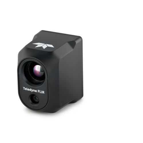
GOLETA, Calif. and ORLANDO, Fla. ― Teledyne FLIR, part of Teledyne Technologies Incorporated, today announced the release of its high-performance Hadron 640R combined radiometric thermal and visible dual camera module. The Hadron 640R design is optimized for integration into unmanned aircraft systems (UAS), unmanned ground vehicles (UGV), robotic platforms, and emerging AI-ready applications where battery life and run time are mission critical.

The 640 x 512 resolution Boson longwave infrared (LWIR) thermal camera inside the Hadron 640R can see through total darkness, smoke, most fog, glare, and provide temperature measurements for every pixel in the scene. The addition of the high definition 64 MP visible camera enables the Hadron 640R to provide both thermal and visible imagery compatible with today’s on-device processors for AI and machine-learning applications at the edge.

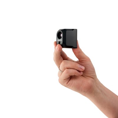
“The Hadron 640R provides integrators the opportunity to deploy a high-performance dual-camera module into a variety of unmanned form factors from UAS to UGV thanks to its incredibly small size, weight, and power requirement,” said Michael Walters, vice president product management, Teledyne FLIR. “It is designed to maximize efficiency and its IP-54 rating protects the module from intrusion of dust and water from the outside environment.”

The Hadron 640R reduces development costs and time-to-market for integrators and original equipment manufacturer (OEM) product developers by offering a complete system through a single supplier, Teledyne FLIR. This includes offering drivers for market-leading processors from NVIDIA, Qualcomm, and more, plus industry-leading integration support and service from a support team of experts. It also offers flexible 60 Hz video output via USB or MIPI compatibility. Hadron 640R is a dual use product and is classified under US Department of Commerce jurisdiction.

The Teledyne FLIR Hadron 640R is available for purchase globally from Teledyne FLIR and its authorized dealers. To learn more or to purchase, visit www.flir.com/hadron640r.

For an exclusive in-person first look at the Hadron 640R, please visit booth #2107 at AUVSI Xponential, April 26-28, 2022, in Orlando, Florida.

About Teledyne FLIR
Teledyne FLIR, a Teledyne Technologies company, is a world leader in intelligent sensing solutions for defense and industrial applications with approximately 4,000 employees worldwide. Founded in 1978, the company creates advanced technologies to help professionals make better, faster decisions that save lives and livelihoods. For more information, please visit www.teledyneflir.com or follow @flir.

About Teledyne Technologies
Teledyne Technologies is a leading provider of sophisticated digital imaging products and software, instrumentation, aerospace and defense electronics, and engineered systems. Teledyne’s operations are primarily located in the United States, the United Kingdom, Canada, and Western and Northern Europe. For more information, visit Teledyne’s website at www.teledyne.com.

The Many Uses of Drone Videography For Event Marketing

This article was written by Anthony Jamison, a representative at Drones Services Phoenix. Anthony Jamison is the head of the Outreach Department of Drone Services Phoenix, Arizona’s premier aerial photography and videography company

There is no question about the impact unmanned aerial vehicles (UAVs) or aerial drones are making across industries these days.

Whether you’re a general contractor, a miner, a roofer, farmer, or a filmmaker, you will surely find suitable uses for an aerial drone, which can reach places and spaces you never imagined would be accessible a decade or so ago.

And today’s drones are not just about physically reaching hard-to-access spots. The fact that most, if not all of them are fitted with high-definition cameras also makes them capable of taking stunning photographs and videos while in flight.

The beauty of aerial drone videography also makes UAVs perfect for marketing activities, specifically event marketing.

If you’re part of a corporate marketing team and you’re organizing a music festival, a trade show, or any event, you might want to make good use of drones in the following ways:

Finding The Perfect Location

You need an open-air venue for your event, and you have already set your sights on a piece of land a few miles from the city.

The place may look good on the ground, but you want a complete idea of what it can offer and what you can do to the area for the event.

The solution? Get a drone in the air and shoot photos and videos of the whole property. With aerial photos and videos on hand, you can make a full assessment of the venue’s event-worthiness and start your planning for the event itself.

Billboards In The Sky

Billboards have always been a staple in marketing and advertising, and they still work, especially those huge ones that nobody can ever miss.

However, you can take things a step further by using flying billboards to market your event. Get a couple of drones, attach banners or tarpaulins to them, and have them fly over certain areas where your billboards in the sky can get the most eyes on them.

Enhanced Security

Your event can always use more security, and drones are more than capable of providing that.

With drones flying overhead during an event, you and your team can easily spot disturbances and possible trouble areas and alert security personnel to them right away.

Live Streaming

Event marketers can use live streaming with drones not only to hype up an event before it takes place but also broadcast the whole thing live to a massive audience while it’s unfolding.

Live streaming drone videos of the venue and the various preparations can help create buzz for the event itself and make people look forward to being there. Your brand’s followers would love to see behind-the-scenes footage of members of your team doing whatever they can to help make the event a success.

Once the event is taking place, a drone with live streaming capabilities can give the people who can’t make it to the venue a chance to see the goings-on while they are going on, making them feel like they’re there with you.

Creating Videos For Social Media

If live-streaming is not possible, you can always have your drone shoot all the necessary shots just the same, then create a video that you can post on all your social media channels.

As much as possible, post your drone videos for your event on YouTube and Facebook. After all, the former is the world’s top video streaming channel, while the latter has close to three billion active users worldwide.

While you’re at it, post your drone videos on your company website, too, since they can also help attract more traffic.

Giving Sponsors Due Credit

More often than not, major events are made possible with the help of corporate and individual sponsors.

You can show your appreciation for their involvement in your event by playing all over the venue videos shot by your drones featuring sponsors’ banners, signage, booths, or any indicator of the help they extended to you.

Celebratory Drone Light Shows

If your budget allows it, putting up a drone light show can serve as a high point for the event itself.

Unlike expensive fireworks, drone light shows don’t disperse toxic pollutants into the air, litter the venue with spent casings, and, more importantly, don’t scare birds, wildlife, and pets to death.

The creative possibilities are also endless, as drones can be used to create every imaginable pattern and shape in every possible color hundreds of feet in the air.

The crowd at your event and the people watching the live stream will indeed find themselves immensely entertained if you close the proceedings with a drone light show.

There are many other possible uses of drones for your event marketing efforts, but the ones listed above should be a good enough place to start.

You can always get a drone or two yourself to use in event marketing, but keep in mind that operating a drone requires a license.

If having your own drone is out of the question, you can always opt to partner with a drone services provider who has the license and the expertise to fly drones safely.